- HomePage
- Product
- Conference
- Marine projects
- Contact Us
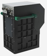
ITRES Airborne Hyperspectral System
The CASI-1500 is a visible near Inflared (VNIR) sensor which offers an impressive 1500 pixels across its field of view, allowing you to image a vast area with a single pass. or achieve spatial resolutions as high as 25cm using a standard fixed-wing aircraft.
ITRES has given this camera an extraordinary sensor array, plus amazing custom optics to provide you with razor sharp focus and superior sensitivity across the entire spectrum. Now you can operate under low light conditions and still acquire superb imagery.
|
|
The TSR-1800’s automated thermal anomaly detection is made possible by the TABI imager’s high temperature and spatial resolution capabilities. Flying low (~500 m or 1627 feet above ground level) achieves a small ground footprint (20 cm) for each pixel. Flying 150 m or 488’ AGL leads to 6 cm pixels.
Searches can also be conducted at high ground speeds (170-300 knots).
The TSR-1800 automatically adjusts its search parameters every minute based on changing aircraft speeds to optimize target detection.
Wide swath coverage is provided by the imager’s 1800 across-track pixels, meaning that while flying at ~1000’ AGL (12 cm resolution) the imaged track on the ground is ~220 m (722’).
Small form factor, 288 channel, programmable, μVNIR1920 wide array hyperspectral pushbroom VNIR imager
Portable Air/Ground Hyperspectral VNIR Imager (0.4–1.0?m)
Self-Contained Camera & Data Recording
288 Spectral Channels
36.6° FOV, 1920 Spatial Imaging Pixels
Cutom Fore-Optics Available
Optional GPS/IMU
Internal Calibration System
Easy Lidar Integration
Remote Operation via R/F Link or Autonomous via Waypoints
Precision Data Time Stamping to External Devices
API Available
Small form factor, broadband, wide array, pushframe thermal imager
Portable Air/Ground Broadband TIR Imager (3.7–4.8?m)
26.99 x 21.73° FOV, 640 Spatial Imaging Pixels
Custom Fore-Optics Available
High Thermal Resolution
Wide Speed Range, Ultra-High Spatial Resolution
Internal Blackbody Calibration Source
Optional GPS/IMU
Easy Lidar Integration
Remote Operation via R/F Link or Autonomous via Waypoints
Precision Data Time Stamping to External Devices
API Available
DATA SURPASS TECHNOLOGY CO., LTD.
1F, No. 22, West District, Zhongmei St. Taichung City , Taiwan