- HomePage
- Product
- Conference
- Marine projects
- Contact Us
TABI-1800 on Discovery Channel
TABI-1800 on Discovery Channel
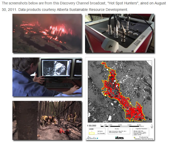
Daily Planet's wildfire mapping story explores the use of the TABI (Thermal Airborne Broadband Imager) in battling a massive Northern Alberta wildfire.
First aired Tuesday, August 30th, this Daily Planet episode looked at the high-tech and low-tech ways that Alberta Sustainable Resource Development mapped the fire perimeter and detected hot spots in battling a huge wildfire Northern Alberta.
The story features the use of the TABI-1800 as it provided fire crews with a "birds-eye view" of the fire, both during active supression efforts as well as during post-fire hot spot mop-up operations. Field-generated analysis map products were used to precisely direct ground crews to hot spot locations, typically with 1m positional accuracy. Hot spots can be difficult to detect through other means, and can remain burning for up to a year at depths of 2m underground.
You can view this story online (requires Flash) from the Discovery Channel website using either of the following links (links open in new windows):
Full Daily Planet Episode. "Hot Spot Hunters" story begins at the 7 minute 12 second mark of show. |
http://watch.discoverychannel.ca/daily-planet/august-2011/daily-planet---august-30-2011/#clip524597 |
Extracted clip of "Hot Spot Hunters" story. Show titling not included. |
http://watch.discoverychannel.ca/daily-planet/august-2011/daily-planet---august-30-2011/#clip525799 |
|
|
DATA SURPASS TECHNOLOGY CO., LTD.
1F, No. 22, West District, Zhongmei St. Taichung City , Taiwan