- HomePage
- Product
- Conference
- Marine projects
- Contact Us
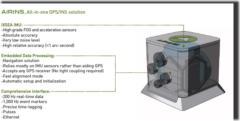
IXSEA AIRINS Inertial Navigation System
AIRINS is a lightweight, all-in-one, real-time georeferencing and positioning system designed to meet the requirements of the most demanding airborne survey and remote sensing applications such as digital cameras, SAR, digital scanners, films cameras and LIDAR.
|
|
Features:
- High performances FOG
- GPS hybridization algorithms
- Compatible with C/A, differential GPS, PPK
- Rugged solid-state sensors
- Single housing integrated system
Benefits:
- High accuracy position, heading, roll, pitch at high update rate
- GPS dropout resistant, real-time performance optimization
- Plug-and-play compatible with most GPS receivers
- Vibration / shock resistant, no maintenance
- Small, lightweight, fast and easy installation
DATA SURPASS TECHNOLOGY CO., LTD.
1F, No. 22, West District, Zhongmei St. Taichung City , Taiwan